Lower Calf Creek
Location: Escalante
Rating: Canyon Hike 1A I
Length: 2-4 hours
Longest Rappel: None
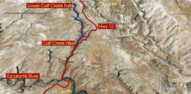
Start: Hwy 12, North of Escalante River 1.1 miles
End: There and Back
Permits: None
Wet Suit: Not needed
Shuttle: No
Overview: Calf Creek Falls is a Southern Utah landmark. You will encounter beaver ponds and Indian hieroglyphs seen off on distant bluffs. Distance to the falls is 2.75 miles. The trail is sandy but easy to follow. The falls provide a cool and shaded area.
Approach: From Escalante travel toward Boulder 14 miles. Turn off left BLM Calf Creek. 11.8 miles south of Boulder.
View Calf Creek Lower.kmz in a larger map
 |
 |
 |
 |
 |