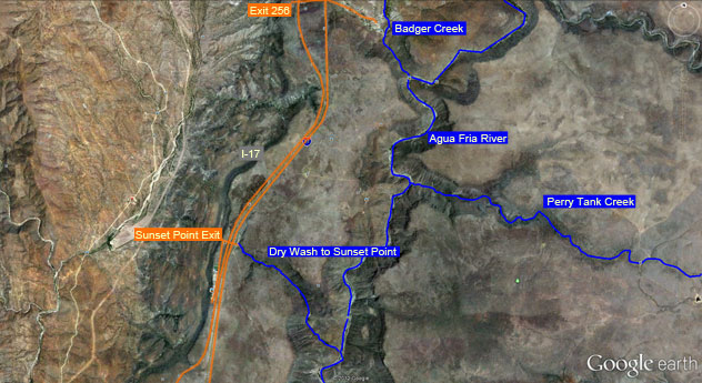
Agua Fria River Canyon
Location: Agua Fria National Monument
Rating: Basic Canyoneering 2B III
Length: 6-10 hours
Longest Rappel: None
Start: Exit 256 (Badger Spring Exit)
End: There and Back
Permits: Permits are required for visiting groups of 25 or more. Commercial guides must also be permitted. A more permitted plan is in process.
Wet Suit: Not needed
Shuttle: No (Optional)
Overview: The Agua Fria River starts in the Prescott National Forest and crosses miles of desert. A small section of the river lies just the east of I-17 and is a fun little hike for canyoneering adventurers. The canyon is open and offers some scrambling and wading/swimming.
Approach: From I-17, south of Spring Valley and north of Black Canyon City, take exit 256 and drive east along the Badger Spring Rd about .78 miles. You will run into a parking lot where the road branches to the left. Park here and walk the trail south along the Badger Creek Trail. Once you enter the Agua Fria River continue down river as long as desired and head back when finished. The half way mark is the Perry Tank Creek which enters the left and heads east. You can park a shuttle at the Sunset Point exit further south of Badger Spring Rd along I-17 and hike the wash out from Agua Fria River. Use a topographical map as not to get lost if you wish to do so.

View Auga Fria River.kmz in a larger map

